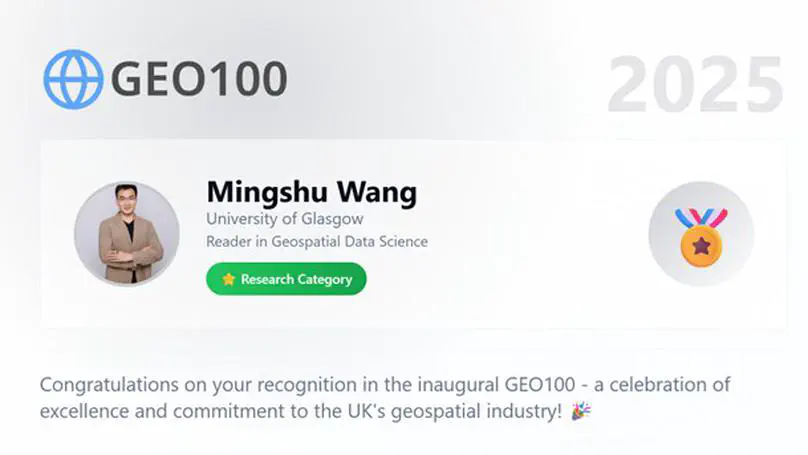
Selected Publications

In Peer-reviewed Journals

(2022). Regional integration in the Horn of Africa through the lens of inter-city connectivity. Applied Geography, 145, 102754.

PDF

(2022). Urban expansion and the urban–rural income gap: Empirical evidence from China. Cities, 129, 103831.

PDF

(2022). Cultivating historical heritage area vitality using urban morphology approach based on big data and machine learning. Computers, Environment and Urban Systems, 91, 101716.

PDF

(2021). Urban morphology and traffic congestion: Longitudinal evidence from US cities. Computers, Environment and Urban Systems, 89, 101676.

PDF

(2021). Simulating the urban spatial structure with spatial interaction: A case study of urban polycentricity under different scenarios. Computers, Environment and Urban Systems, 89, 101677.

PDF

(2021). Measuring polycentric urban development: The importance of accurately determining the ‘balance’ between ‘centers’. Cities, 111, 103009.

PDF

(2021). Built environment and early infection of COVID-19 in urban districts: A case study of Huangzhou. Sustainable Cities and Society, 66, 102685.

PDF

(2021). Polycentric urban development and urban amenities: Evidence from Chinese cities. Environment and Planning B: Urban Analytics and City Science, 48(3), 400-416.

PDF

(2020). Urbanization’s effects on the urban-rural income gap in China: A meta-regression analysis. Land Use Policy, 99, 104995.

Source Document

(2020). Urban form, shrinking cities, and residential carbon emissions: Evidence from Chinese city-regions. Applied Energy, 261, 114409.

PDF Source Document

(2020). Road network structure and ride-sharing accessibility: A network science perspective. Computers, Environment and Urban Systems, 80, 101430.

Source Document

(2019). Polycentric urban development and economic productivity in China: A multiscalar analysis. Environment and Planning A: Economy and Space, 51(8), 1622-1643..

Source Document

(2019). Bike-sharing or taxi? Modeling the choices of travel mode in Chicago using machine learning. Journal of Transport Geography, 79, 102479.

Source Document

(2018). Spatial disparities of Uber accessibility: An exploratory analysis in Atlanta, USA. Computers, Environment and Urban Systems, 67, 169-175.

Source Document

(2017). Exploring the Relationship between Urban Forms and CO2 Emissions in 104 Chinese Cities. Journal of Urban Planning and Development, 4, 04017014.

Source Document

(2017). Bike-sharing systems and congestion: Evidence from US cities. Journal of Transport Geography, 65, 147-154.

Source Document

(2017). A two-level comparison of CO2 emission data in China: Evidence from three gridded data sources. Journal of Cleaner Production, 148, 194-201.

Source Document

(2016). Crowdsourcing the landscape of cannabis (marijuana) of the contiguous United States. Environment and Planning A: Economy and Space, 48(8), 1449-1451.

Source Document

(2016). How polycentric is urban China and why? A case study of 318 cities. Landscape and Urban Planning, 151, 10-20 (Equal Contribution).

Source Document

(2016). Outside the ivory tower: visualizing university students’ top transit-trip destinations and popular corridors. Regional Studies, Regional Science, 3(1), 202-206.

PDF Source Document

All Publications

In Peer-reviewed Journals

(2022). Regional integration in the Horn of Africa through the lens of inter-city connectivity. Applied Geography, 145, 102754.

PDF

(2022). Urban expansion and the urban–rural income gap: Empirical evidence from China. Cities, 129, 103831.

PDF

(2022). Understanding taxi ridership with spatial spillover effects and temporal dynamics. Cities, 125, 103637.

Source Document

(2022). Embedding Artificial Intelligence in Society: Looking Beyond the EU AI Master Plan Using the Culture Cycle. AI & Society.

PDF

(2022). Cultivating historical heritage area vitality using urban morphology approach based on big data and machine learning. Computers, Environment and Urban Systems, 91, 101716.

PDF

(2021). Urban morphology and traffic congestion: Longitudinal evidence from US cities. Computers, Environment and Urban Systems, 89, 101676.

PDF

(2021). Simulating the urban spatial structure with spatial interaction: A case study of urban polycentricity under different scenarios. Computers, Environment and Urban Systems, 89, 101677.

PDF

(2021). Measuring polycentric urban development: The importance of accurately determining the ‘balance’ between ‘centers’. Cities, 111, 103009.

PDF

(2021). Built environment and early infection of COVID-19 in urban districts: A case study of Huangzhou. Sustainable Cities and Society, 66, 102685.

PDF

(2021). Polycentric urban development and urban amenities: Evidence from Chinese cities. Environment and Planning B: Urban Analytics and City Science, 48(3), 400-416.

PDF

(2020). Urbanization’s effects on the urban-rural income gap in China: A meta-regression analysis. Land Use Policy, 99, 104995.

Source Document

(2020). Where we are in fighting against the COVID-19. Environment and Planning A: Economy and Space, 52(8), 1483-1486.

PDF Source Document

(2020). Urban form, shrinking cities, and residential carbon emissions: Evidence from Chinese city-regions. Applied Energy, 261, 114409.

PDF Source Document

(2020). Road network structure and ride-sharing accessibility: A network science perspective. Computers, Environment and Urban Systems, 80, 101430.

Source Document

(2019). Polycentric urban development and economic productivity in China: A multiscalar analysis. Environment and Planning A: Economy and Space, 51(8), 1622-1643..

Source Document

(2019). Bike-sharing or taxi? Modeling the choices of travel mode in Chicago using machine learning. Journal of Transport Geography, 79, 102479.

Source Document

(2019). A Robust Noise Mitigation Method for the Mobile RFID Location in Built Environment. Sensors, 19(9), 2143.

PDF Source Document

(2019). Predicting overall customer satisfaction: Big data evidence from hotel online textual reviews. International Journal of Hospitality Management, 76, Part A, 111-121.

Source Document

(2019). Travel distance and hotel service satisfaction: An inverted U-shaped relationship. International Journal of Hospitality Management, 76, 261-270.

Source Document

(2018). Polycentric urban development in China: A multi-scale analysis. Environment and Planning B: Urban Analytics and City Science, 45(5), 953-972.

Source Document

(2018). Sleepless nights in hotels? Understanding factors that influence hotel sleep quality. International Journal of Hospitality Management, 74, 189-201.

Source Document

(2018). A low-cost collaborative locating scheme with GNSS and RFID for the Internet of Things. ISPRS International Journal of Geo-Information, 7(5), 180 (Corresponding Author).

PDF Source Document

(2018). Spatial disparities of Uber accessibility: An exploratory analysis in Atlanta, USA. Computers, Environment and Urban Systems, 67, 169-175.

Source Document

(2017). Exploring the Relationship between Urban Forms and CO2 Emissions in 104 Chinese Cities. Journal of Urban Planning and Development, 4, 04017014.

Source Document

(2017). Bike-sharing systems and congestion: Evidence from US cities. Journal of Transport Geography, 65, 147-154.

Source Document

(2017). Big data for intrametropolitan human movement studies: A case study of bus commuters based on smart card data. International Review for Spatial Planning and Sustainable Development, 5(3), 100-115 (Corresponding Author).

Source Document

(2017). Modeling projected changes of mangrove biomass in different climatic scenarios in the Sunda Banda Seascapes. International Journal of Digital Earth, 10(4), 457-468.

Source Document

(2017). A two-level comparison of CO2 emission data in China: Evidence from three gridded data sources. Journal of Cleaner Production, 148, 194-201.

Source Document

(2017). From stay to play – A travel planning tool based on crowdsourcing user-generated contents. Applied Geography, 78, 1-11.

Source Document

(2016). Crowdsourcing the landscape of cannabis (marijuana) of the contiguous United States. Environment and Planning A: Economy and Space, 48(8), 1449-1451.

Source Document

(2016). Visualizing pesticide usage in the United States from 1992 to 2009. Environment and Planning A: Economy and Space, 48(3), 455-457.

Source Document

(2016). Geography matters in online hotel reviews. ISPRS - International Archives of the Photogrammetry, Remote Sensing and Spatial Information Sciences, XLI-B2, 573-576.

Source Document

(2016). How polycentric is urban China and why? A case study of 318 cities. Landscape and Urban Planning, 151, 10-20 (Equal Contribution).

Source Document

(2016). Outside the ivory tower: visualizing university students’ top transit-trip destinations and popular corridors. Regional Studies, Regional Science, 3(1), 202-206.

PDF Source Document

(2015). Delineating biophysical environments of the Sunda Banda Seascape, Indonesia. Int J Environ Res Public Health, 12(2), 1069-1082.

PDF Source Document

(2012). Evaluating intensive land use situation of development zone based on cloud models. Transactions of the Chinese Society of Agricultural Engineering, 28(10), 247-252 (In Chinese).

Source Document

Other Publications

GUEST-EDITED JOURNAL VOLUMES

  • Wang, M., Persello, C. (2020). Integrating Remote Sensing and Urban Informatics. Special Issue Remote Sensing
  • Fu, P. Wang, M., Xie, Y., Hu, L. (2020). Urban resilience: adapting city to climate change and sustainability. Special Issue Cities and Environment Interactions
  • Madden, M., Wang, M., Paudyal, D., Vacca, G. (2020). Integrating GIS and Internet of Things (IoT) in Sustainable Cities. Special Issue ISPRS International Journal of Geo-Information.
  • Peng, B., Du, Z., Jin, Z., Wang, M. (2020). Big data for sustainable development: new advances in theories, data collection techniques, analysis algorithms, intelligent systems, knowledge discoveries, and ethics. Collection Frontiers in Big Data.
  • Haworth, J., Dragicevic, S., Madden, M., Wang, M., Huang, H. (2019). Deep Learning and Computer Vision for Geoinformation Sciences. Special Issue ISPRS International Journal of Geo-Information.
  • Madden, M., Vacca, G., Paudyal, D., Wang, M. (2018). Geospatial Applications of the Internet of Things (IoTs). Special Issue ISPRS International Journal of Geo-Information.

BOOK CHAPTERS

  • Wang, M. (2020). Empirical Mode Decomposition in Remote Sensed Image Processing. In Chapter 7: Image Processing and Analysis Methods, ASPRS Manual of Remote Sensing, 4th Edition. Edited by Brandades, S. & Madden, M. DOI: https://doi.org/10.14358/MRS/Chapter7

BOOK REVIEWS

  • Wang, M. (2018). Integrating Scale in Remote Sensing and GIS, Edited by Quattrochi, D., Wentz, E., Lam, N., Emerson, C. CRC Press, Boca Raton, FL, USA. Jan 19, 2017. 402p. Photogrammetric Engineering & Remote Sensing, 84(11), 673.
  • Wang, M. (2016). Location Is (Still) Everything: The Surprising Influence of the Real World on How We Search, Shop, and Sell in the Virtual One, David R. Bell. Houghton Mifflin Harcourt, Boston, MA, July 15, 2014. 240p. Southeastern Geographer, 56*(4), 476-477.
  • Wang, M.(2015). Global Urban Monitoring and Assessment through Earth Observation, Edited by Weng, Q. CRC Press, Boca Raton, FL, USA. May 23, 2014. 440p. Photogrammetric Engineering & Remote Sensing, 81(9), 692-694.

Projects

Ride-sharing Accessibility

Disparities of accessibility in transportation systems is a constant concern, which is intensified by the transportation economization process and the digital divide. How should we measure and understand the accessibility of ride-sharing systems?

Polycentricity & Carbon Emissions

We explored the relationship between urban forms (e.g., polycentricity and compactness) and carbon dioxcide emissions in over 100 Chinese cities.

Bike-sharing Systems & Congestion

In the past decades, there has been a resurgence of public bike-sharing systems (BSSs). While it is claimed that social and environmental benefits are associated with the implementation of BSSs, few empirical studies have investigated the actual effect of BSSs on cities.

Plan Your City Trip based on User-generated Contents

This project proposes a travel planner for city trips by integrating multiple crowdcoursed user-generated contents to provide cutomized information for tourists. We harvested hotel reviews from TripAdvisor, photos from Flickr, and travel costs from Uber.

How Polycentric is Urban China?

We quantified the degree of polycentric urban development at both intra-urban and inter-urban levels in China with the U.S. Oak Ridge National Laboratory (ORNL)’s LandScan dataset.

Public Transport Smart Card in Beijing

Geo-visualizations derived from public transport smart card users in Beijing.

Students

I have supervised the following PhD and MSc students:

Student Degree Program Topic Year
Yue Li Ph.D. Prediction urban traffic flows with emerging urban big data by deep learning and computer vision 2021-2024
Wu Cai Ph.D. A pattern language approach enhanced with urban dynamic data for morphological analysis and simulation in urban design 2020-2023
Nadia Shafaeipoursarmour Ph.D. Measuring pedestrian dynamics 2020-2024
Ting Zhou Ph.D. Urban green space and physical activities 2020-2024
Zimo Zhou MSc. (Geomatics) Geospatial Data Science 2021-2022
Zehui Zhang MSc. (Geomatics) Geospatial Data Science 2021-2022
Xin Gao MSc. (Geomatics) Geospatial Data Science 2021-2022
Jiren Wang MSc. (Geomatics) Geospatial Data Science 2021-2022
Xinyue Sun MSc. (Geomatics) Geospatial Data Science 2021-2022
Jiale Quan MSc. (Geomatics) Geospatial Data Science 2021-2022
Praneeth Kadiyam MSc., Geoinformatics Understanding Built Environments with Street View Services 2019-2021
Yun Xu MSc., Geoinformatics Built Environment and Hotel Attractiveness: A Case study in New York City based on Geodata Science and Machine Learning 2018-2020
Mahshid Ghaffari MSc., Geoinformatics, Double-degree with KNTU Understanding Network Complexity from OpenStreetMap 2018-2020
Laurens Kik MSc., GIMA Mapping Urban Heat Islands 2017-2019

I served as a committee member/examiner for the following students:

Student Degree Program Topic Year
Wan Li Post-doc, East China Normal University, China Urban polycentricity and economic productivity in China 2020
Weiye Wang PhD, University of Georgia, USA Using a matrix-based approach to investigate affordance-based design in pedestrian streets 2022-
Yuzhou Chen PhD, University of South Florida, USA Proposing coordinated urban development strategies for cities networked by spatial flows 2019-
Tongjing Wang PhD, Delft University of Technology, NL Regional Virtual Interaction Analysis using Complex Network Theory 2019-
Bram Roozen MSc., GIMA Crawling the world wide web to find hidden patterns of people 2019-2021
Rosalie Kremser MSc., Cartography Multi-Hazard Risk Assessment using GIS in urban areas 2019-2021
Wei Li MSc., Urban Planning and Management Property valuation using deep learning 2018-2020
Robert van Hoek MSc., GIMA Empirical foundation of User Generated Content as input for policymaking: Finding spatial patterns in Recreational Cycling 2017-2019

Selected Invited Talks

Year Institute(s)
2022 ESRC Urban Big Data Center (UBDC), CPGIS Educational Webinar Series, City+ Lecture Series on Shared Micromobility, University of Leeds
2021 Alan Turing Institute, East China Normal University, The Chinese University of Hong Kong,The Hong Kong Polytechnic University, University of Liverpool
2020 Beijing Normal University, Linköping University, Nanjing University, Nanjing Normal University, University of Amsterdam, United Nations University and Maastricht University, University of Glasgow
2019 Chinese Academy of Science, Eindhoven University of Technology, Henan University, Peking University, Tongji University, University of Liverpool, University of Manchester, University of Toronto, Zhejiang University
2018 Chinese Academy of Science, East China Normal University, Guilin University of Electronic Technology, Loughborough University, Nanjing University, New York University, Shanghai New York University (NYU-Shanghai), Northeastern University (China), University of Electronic Science and Technology of China, University of Liverpool, University of North Carolina at Greensboro, University of North Texas, University of Toronto, University of Twente
2017 East China Normal University, Huazhong University of Science and Technology, Southwest University
2016 TEDxUGA, East China University of Science and Technology, Guangzhou University, Northwestern Polytechnical University, University of Liverpool
2015 NOAA National Centers for Environmental Information, Sun Yat-sen University
2014 Columbia University

Teaching

I received my University Teaching Qualification, UTQ in 2020.

I have taught the following courses at the University of Glasgow, United Kingdom:

Year Course Level Role(s)
2021 Principles of GIS Graduate Coordinator + Lecturer
2021 Geospatial Fundamentals Graduate Lecturer

I have taught the following courses at the University of Twente, the Netherlands:

Year Course Level Role(s)
2018, 2019, 2020, 2021 Academic Skills Graduate Coordinator + Lecturer
2019, 2020 HTHT Minor Geographic Information Systems (GIS) Undergraduate Coordinator + Lecturer
2019, 2020, 2021 Integrated Geospatial Workflow Graduate Lecturer
2019 Big Geodata Processing Graduate Lecturer
2019 Methods and Techniques for Geo-information Management and Application Graduate Lecturer

I have taught the following courses at the University of Georgia, USA:

Year Course Level Role(s)
2018 Programming for GIS (GEOG 4590L/6590L) Undergraduate + Graduate Lab Instructor
2017 Aerial Photographs and Image Interpretation (GEOG 4330L/6330L) Undergraduate + Graduate Lab Instructor
2016 Aerial GIScience and GITechnology Undergraduate Guest Lecturer
2013 Introduction to Physical Geography (GEOG 1111) Undergraduate Teaching Assistant
2012 The Logic and Practice of Sociological Research (SOCI 3600) Undergraduate Teaching Assistant

Service

Organizational Roles within Professional Societies

Year Role
2015- Secretary, Working Group IV/6—Internet of Things and Spatial Decision Support, International Society for Photogrammetry and Remote Sensing (ISPRS)
2019- Expert Supporter Confederation of Laboratories for Artificial Intelligence Research in Europe (CLAIRE)
2019- Supporter European Laboratory for Learning and Intelligent Systems (ELLIS)
2020-2021 Board of Director Member Chinese Professionals of Geographical Information Science (CPGIS)
2017- 2018 Councilperson, Mid-South Region, American Society for Photogrammetry and Remote Sensing (ASPRS)
2014-2015 Chair, Student Advisory Council, American Society for Photogrammetry and Remote Sensing (ASPRS)
2013-2014 Deputy Chair, Student Advisory Council, American Society for Photogrammetry and Remote Sensing (ASPRS)

Editorial Positions

Year Role Journal
2021- Editor Asian Geographer
2021- Associate Editor ISPRS International Journal of Geo-Information
2020- Associate Editor Regional Studies, Regional Science
2021- Editorial Board Member Computers, Environment and Urban Systems
2021- Editorial Board Member Transactions in Urban Data, Science, and Technology
2020- Editorial Board Member UCL Open: Environment
2019- Editorial Board Member Remote Sensing
2019- Editorial Board Member PLOS ONE

Conference Program Committee

Year Conference Location
2021 XXIV ISPRS Congress Nice, France
2020 The 3rd ACM SIGSPATIAL International Workshop on Advances in Resilient and Intelligent Cities (ARIC 2020) Seattle, USA
2020 The 19th IEEE International Conference on Machine Learning and Applications) Miami, USA
2020 Climate Change and Disaster Management (CCDM2020) Sydney, Australia
2020 The 3rd AAG GeoAI and Deep Learning Symposium Denver, USA
2020 International Symposium on Spatio-Temporal Artificial Intelligence London, UK
2019 The 4th International Conference on Smart Data for Smart Cities Kuala Lumpur, Malaysia
2019 The 2nd AAG GeoAI and Deep Learning Symposium Washington, D.C., USA
2018 ISPRS Technical Commission IV Symposium 2018 Delft, Netherlands
2018 The 3rd international Conference on Smart Data for Smart Cities Delft, Netherlands
2017 The 2nd international Conference on Smart Data for Smart Cities Puebla, Mexico
2016 ASPRS 2016 Annual Conference Fort Worth, TX, USA
2015 IEEE International Smart Cities Conference Guadalajara, Mexico

Conference Session Chair

Year Conference Session Location
2020 Interconnected: Resilience Innovations for Sustainable Development Goals Urban Resilience Delft, Netherlands
2019 International Conference on Geomatics in the Big Data Era Big Data Applications Guilin, China
2019 The 25th International Sustainable Development Research Society Conference Urban Resilience Nanjing, China
2016 XXIII ISPRS Congress Location-based Social Media Data Prague, Czech Republic
2014 2014 ASPRS Annual Conference GeoLeague Challenge Louisville, KY, USA

Peer Reviewer for Grants

  • Dutch Research Council (NWO, Nederlandse Organisatie voor Wetenschappelijk Onderzoek)
  • US National Science Foundation (NSF)
  • Estonian Research Council (ETAg)
  • Vienna Science and Technology Fund (Wiener Wissenschafts-, Forschungs- und Technologiefonds, WWTF)
  • Hong Kong Environment and Conservation Fund (ECF)
  • Xi’an Jiaotong-Liverpool University (XJTLU) Postgraduate Research Scholarship

Peer Reviewer for Selected Academic Journals

  • Publons Top Reviewers in Social Sciences (top 1% of reviewers): 2018, 2019

Selected Awards

Year Award
2019 RSAI Dissertation Award, Regional Science Association International (RSAI)
2019 NCG Talent Program, The Netherlands Centre for Geodesy and Geo-Information (NCG)
2019 Chinese Government Award for Outstanding Students Abroad, China Scholarship Council (CSC)
2018 Robert N. Colwell Memorial Fellowship, American Society for Photogrammetry and Remote Sensing (ASPRS)
2018 Graduate School Travel Grant, University of Georgia
2018 Finalist, Geographic Information Science and Systems Specialty Group, AAG
2017 Student Fellowship, The Federation of Earth Science Information Partners (ESIP)
2017 Early Career Researcher Award, Commended, The Royal Town Planning Institute (RTPI)
2017 NSF Travel Grant, 2017 EarthCube All-Hands Meeting
2017 The 10th Annual PhD Sustainability Academy, IVEY Business School
2017 Summer Doctoral Research Fellowship, University of Georgia
2017 Graduate School Travel Grant, University of Georgia
2016 YSSP Fellowship, International Institute for Applied Systems Analysis (IIASA)
2016 Vice President’s Public Service and Outreach Assistantship, University of Georgia
2016 International Research Fellowship, University of Georgia—University of Liverpool
2016 NSF Travel Grant, CyberGIS Curriculum Workshop
2015 Finalist, The World Bank’s Urbanization in East Asia Research Competition
2015 NSF Travel Grant, CyberGIS All-Hands Meeting
2014 Masters Scholarship, Cartography and Geographic Information Society (CaGIS)
2014 Outstanding Leader, University of Georgia Pandora Yearbook
2013 Fellowship and Travel Grants, Oak Ridge Institute of Science and Education (ORISE)
2013 Finalist, SEDAAG Graduate Honors Masters Paper Contest
2008—2012 People’s Scholarship, Nanjing University
2012 The 3rd Prize, The 5th Geographic Graduates Forum of Nanjing, China
2011 Meritorious Winner, U.S. Mathematical Contest in Modeling (MCM)
2011 Horizon Scholarship, Land Surveying and Planning Institute of Jiangsu, China
2011 Honorable Winner, The 4th Geographic Graduates Forum of Nanjing, China
2011 The 1st Grade, The 14th Forum of Sciences and Arts of Nanjing University
2010 The 3rd Place, The 2nd National Undergraduate Field Survey Competition, Geographic Society of China

Contact

  • mingshu.wang@glasgow.ac.uk
  • School of Geographical and Earth Sciences, East Quadrangle, University of Glasgow, Glasgow, G12 8QQ, United Kingdom